The Raw Wild of the Rawah Wilderness
August 5, 2024
Have you ever been to the Rawah Wilderness? Pronounced “Ray-Wah”, this word translates many different ways in different cultures - it can mean rest & repose, achievement or success, or even charm & beauty. But the literal translation from native Ute tribes is “wilderness” or “wild place”. This vast wilderness is nearly 74,000 acres and has over 75 miles of trails, along with over 25 lakes. This pristine wilderness sits among the Medicine Bow mountains, which extend into southern Wyoming. To the south, you may get views of the Never Summer Mountains, including the iconic Nokhu Crags, and Rocky Mountain National Park. Last weekend, we decided to dive deeper into this wilderness area and experience some of what it has to offer!
You can access the area by traveling west up Poudre Canyon (highway 14) or traveling east on highway 14 from the Walden area to Laramie River Road. This is the main road through the whole area, and it continues all the way up into Wyoming. There are several county roads off this main road that can take you on a variety of adventures - whether its to a trailhead, a campground, out into the sagebrush steppe, or up to a alpine adventure, the possibilities are endless.
The entrance to Laramie River Road sits near the base of Cameron Peak and along Chambers Lake off Highway 14/Poudre Canyon
We arrived at Laramie River Road around noon - getting a bit of a late start that day. We made our way past Chambers Lake, enjoying the sweeping views of the lake in front of Cameron Peak. Once past the lake, the scenery changes to riparian habitat and you just hope you’ll see a moose! Lucky us, we made it around a corner and there before us was a beautiful cow moose with her adorable calf!
It was such a treat to see this pair in the middle of the day! We checked each other out for a few minutes, then mom and baby made their way up the steep hill and into the wilderness. It was amazing to see how well moose can climb!
After the moose, we drove a bit further and were listening for birds. We kept hearing a nice variety of familiar species, but then we started hearing a bird we didn’t recognize. We stopped and tried to use our Merlin app to identify it, but it wasn’t picking it up! We spent almost an hour trying to locate the bird, and while we were looking we were zoomed by several Broad-tailed Hummingbirds, saw & heard Western Wood Pewees hunting insects, and listened to the Song Sparrows sing. FINALLY, Don spotted what we think was making the sound - a fledgling bird! After watching the young bird for a few minutes, an adult finally flew in to feed it - it was a WESTERN TANAGER!
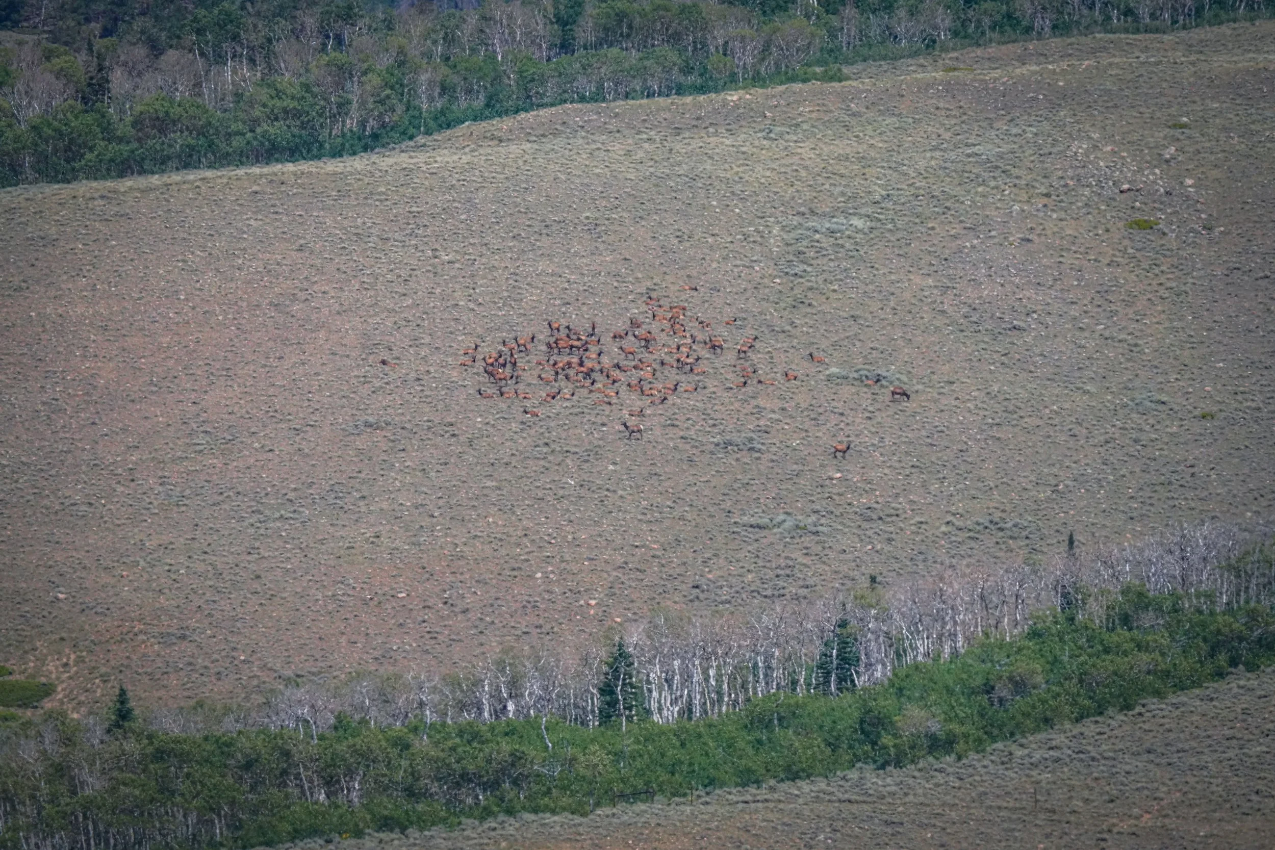
I think we also heard a Golden-crowned Kinglet calling, which we may have confused with the Western Tanager fledgling. After we watched the tanagers for a bit, we got back on the road to see what else we could find! We made it a few miles and the scenery changed from pine forest to sagebrush steppe, and the land opened up for miles and miles. Driving along, the wind started picking up over the vast expanse, and it looked like there was nothing around, just sagebrush and dust as far as the eye could see. Then, as if out of nowhere, we spotted a huge group of elk! There must have been at least 50 in the herd! We stopped and got our binoculars out to take a closer look. The herd consisted primarily of cows & calves and a few young bulls. The elk were quite a distance away (probably a mile or more), but they noticed us as soon as we stopped. We stayed parked and had our lunch as we glassed the surrounding land. On the other side of the road we found more elk! There were so many of them!
(click on each photo to enlarge)
After enjoying our lunch and watching the elk for awhile, we decided to keep heading north towards Wyoming. A few more miles up the road, we drove by a state wildlife area called Hohnholz Lakes. This remote wildlife area sits on public BLM land, state land, and private land. The road through the area winds through a variety of habitats, including sagebrush & riparian. When we arrived, we immediately started seeing a variety of birds, including Brewer’s Blackbirds, Common Ravens, Tree and Violet-green Swallows, Sandhill Cranes, Brown-headed Cowbirds, Ring-billed Gulls, Double-crested Cormorants, and Turkey Vultures. We even spotted mountain lion tracks near one of the lakes!
(click on each image to enlarge)
What a beautiful area, one we definitely want to explore again! Reluctantly, we got back on the road and headed toward a turn that would loop us back to Laramie River Road. We hoped we would find some moose on the drive since it followed a leg of the Laramie River and rich riparian habitat full of willows and aspen trees (a beautiful area to explore & photograph in the fall). Although the drive was beautiful, we didn’t end up seeing much wildlife. We did, however, get a flyover by a group of Red Crossbills! If you are looking for a secluded place to camp and hike, you should check out Brown’s Park Campground, it’s adjacent to Link-McIntyre Trailhead.
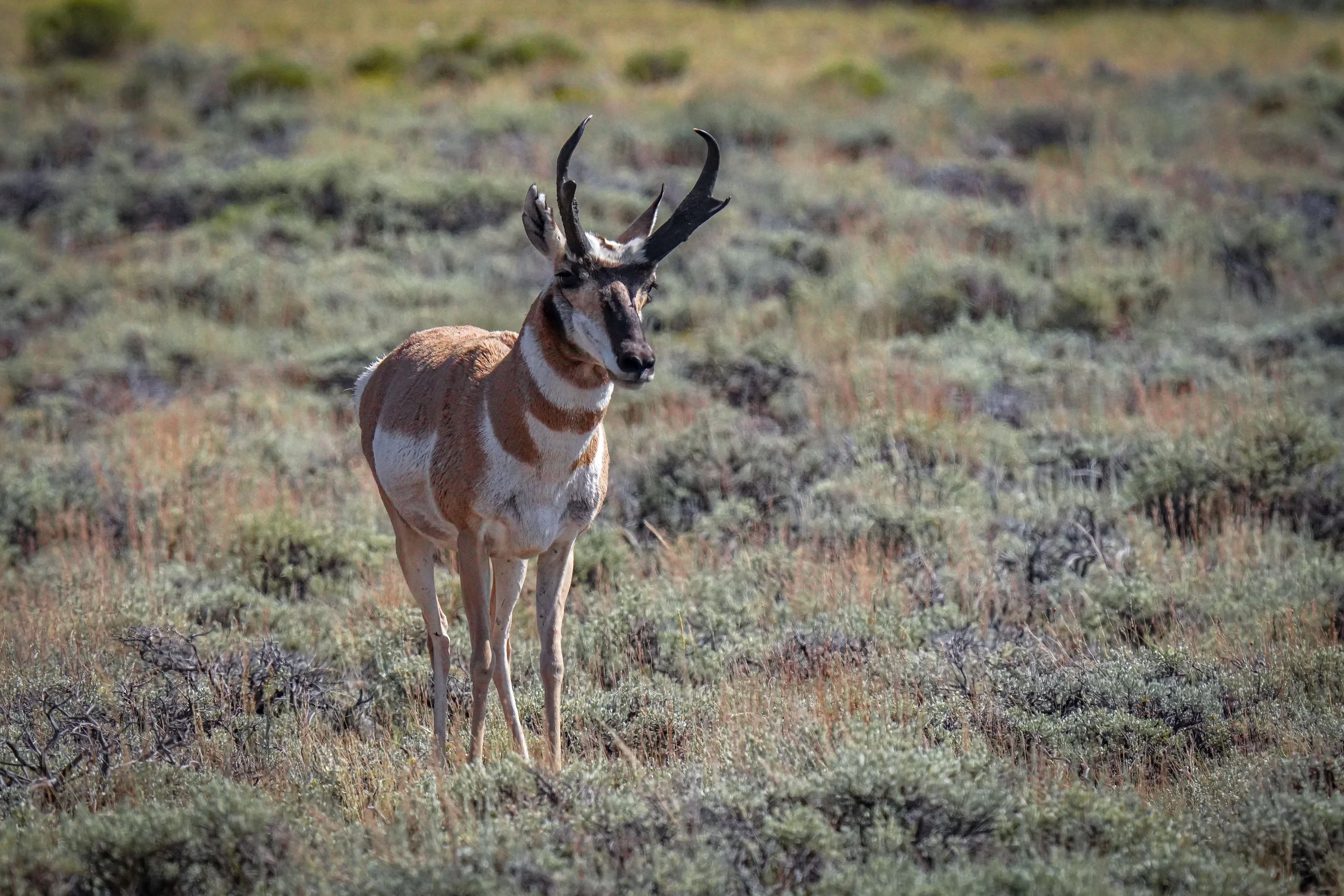
As we were driving towards Hohnholz Lakes, we noticed a road that headed east and said “Red Feather Lakes”. Intrigued, we decided we would loop back around north and try the drive over to Red Feather Lakes to head home. We started our drive up Laramie River Road again, and passed by where we had seen the elk. We couldn’t see them anymore, but as we crested a small hill, there they all were, much closer to the road this time! Near them, we also saw a couple pronghorn does and their fawns!
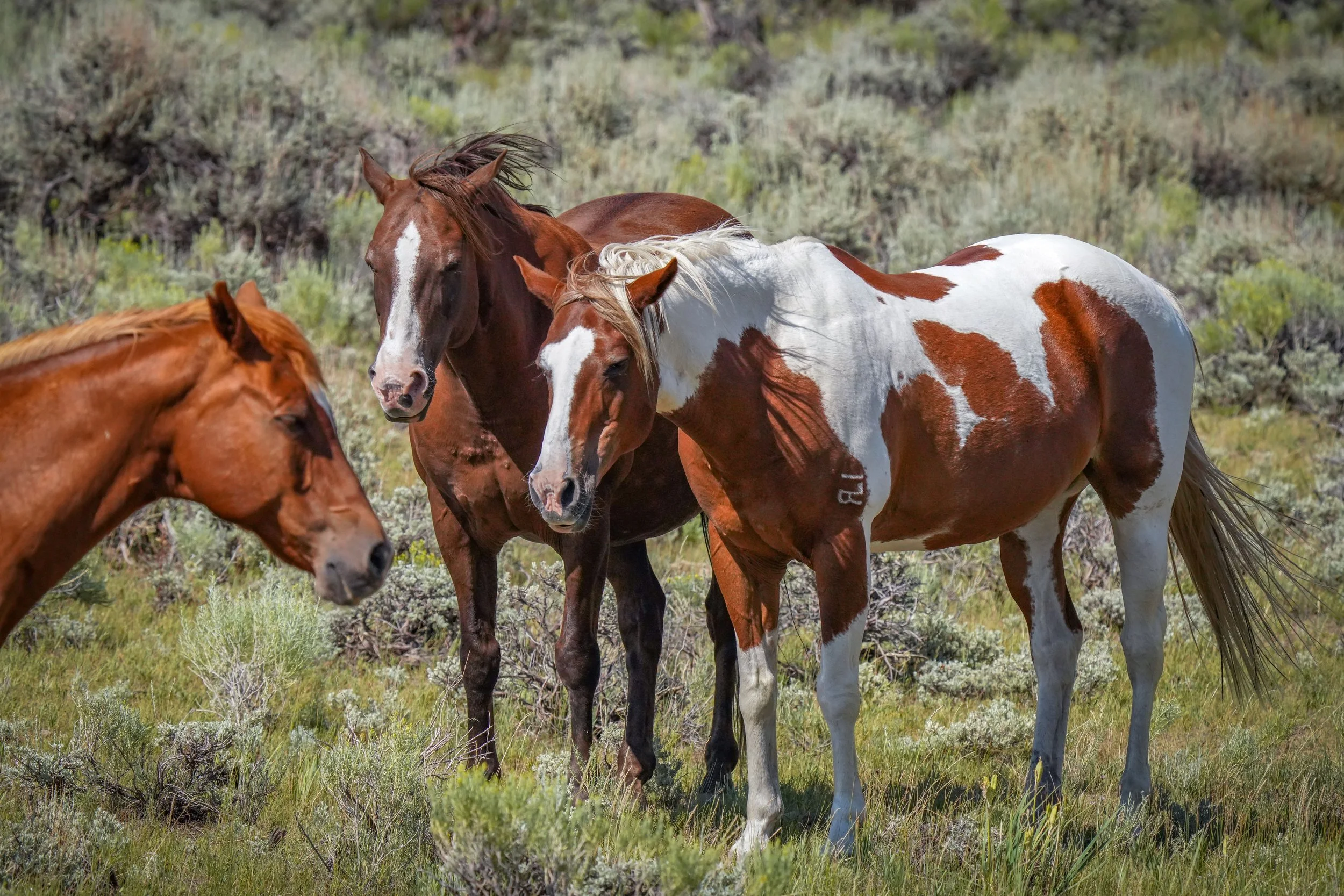
Moving up the road a bit more, we had to stop again to look at some beautiful horses and adorable burro!
We turned right on country road 80 to begin our journey toward home. My favorite time of day was upon us, and I was really excited to see what we might find on this new road we’d never driven! The road up and over the mountains is actually called “Deadman Rd”. I had no idea what to expect, except that the road peaked at a little over 10,000 foot elevation. We steadily climbed up the side of the mountain along the narrow roadway. We saw Mountain Bluebirds fluttering along beside us as we drove. Soon, we entered into a think pine forest. Views became limited, and we had tall, tall trees surrounding us. We actually encountered some traffic coming the other direction, which was encouraging that we would actually make it out to the other side. We made it to the highest point of the road and took a few minutes to get out and stretch and look at the views. The only sounds we heard were marmots chirping!
(click on each photo to enlarge)
At the top of the pass, the landscape flattened out a bit and vast amounts of willows were growing along with aspen trees sprinkled in. This would be another beautiful drive to take in the fall. It was perfect habitat for moose, but we still didn’t see any. The sun started setting and would peek through the pines at us as we descended to the Red Feather Lakes side of the pass. We gradually started seeing more people and knew we would be getting close to Red Feather Lakes soon. As we made it down to the end of the country road, we started seeing a flurry of activity in the trees - lots of birds! We stopped to check them out and see what the fuss was about.
(click on each image to enlarge)
PYGMY NUTCHATCHES! And YELLOW-RUMPED WARBLERS! We enjoyed watching the birds flit about for a few minutes before we ended our day taking in the views at Dowdy Lake Campground and along highway 287 on the way home.
What a great day spent in the mountains!
If you’re interested in getting more information about the area and where we visit, please email me at laura@lnsphotography.net!


